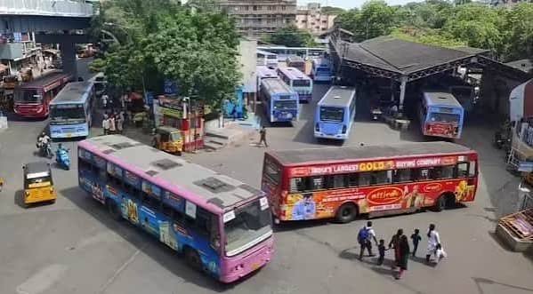
Thiyagaraya Nagar Bus Depot serves the neighbourhood that holds a genuinely singular place in Chennai’s urban history — T. Nagar was the city’s first planned township, laid out between 1923 and 1925 by the Madras Presidency government to address a severe housing shortage, transforming what had been a drained lakebed into a radial grid of streets that still defines the area a century later. This MTC depot moves commuters through a locality whose very layout tells the story of early 20th-century Madras politics, long before it became known as one of Asia’s busiest shopping districts.
Thiyagaraya Nagar Bus Depot Overview
| Detail | Information |
| Operated By | Metropolitan Transport Corporation (MTC), Chennai |
| Location | Thiyagaraya Nagar (T. Nagar), Chennai |
| Founded | 1923–1925, Chennai’s first planned township |
| Named After | Sir Pitti Theagaraya Chetty |
| Central Landmark | Panagal Park (8 acres) |
| Major Routes | 3 (T Nagar–Thiruvanmiyur), 5B, 5C, 5G |
| Historic Boundaries | Mambalam High Road, Mount Road, Bazullah Road, Burkitt Road |
Chennai’s First Planned Township
Before T. Nagar existed, this stretch of the city was simply East Mambalam, part of a village landscape bordered by the Long Tank, a substantial lake extending from Nungambakkam toward Saidapet. When the Justice Party rose to power in the Madras Presidency, the government under the Raja of Panagal initiated the Mambalam Town Planning Scheme in 1921, draining the lake and laying out what became the Presidency’s first organized urban colony under the Madras Town Planning Act of 1920.
This wasn’t incidental development — it was a deliberate response to a genuine housing shortage affecting Madras’s growing middle class, with the new township carefully designed to include housing areas, parks, schools, hospitals, temples, and shops from the outset. The area was named Thyagaraya Nagar after Sir P. Theagaraya Chetty, a founding figure of the Justice Party, while the central park honoured the Raja of Panagal himself, the Presidency’s prime minister who oversaw the project.
The Radial “Rising Sun” Design
What genuinely sets T. Nagar apart from most Indian urban neighbourhoods is its deliberate radial street layout, a design choice that departed significantly from the organic, unplanned growth pattern typical of most Indian cities at the time.
- Panagal Park sits at the physical and symbolic centre of the neighbourhood, with six major roads radiating outward in a pattern resembling a rising sun.
- North Usman Road extends toward Kodambakkam, while South Usman Road runs toward Saidapet, together forming the area’s primary north-south artery.
- N. Chetty Road heads northeast toward Gemini Circle, Thyagaraya Road (known locally as Pondy Bazaar) extends east toward Teynampet, and Venkatanarayana Road runs southeast toward Nandanam Junction.
- Doraiswamy Road completes the radial pattern, extending west toward West Mambalam.
- This European-inspired layout was a genuine departure from typical Madras Presidency planning norms of the era, designed specifically to accommodate the housing and commercial needs of the city’s expanding middle class.
Locating the Depot
Thiyagaraya Nagar Bus Depot sits within this historically planned neighbourhood, positioned close to Panagal Park and the radial street network defining the area.
- The depot connects directly to the area’s historic boundaries — Mambalam High Road to the west, Mount Road (Anna Salai) to the east, Bazullah Road to the north, and Burkitt Road to the south.
- Panagal Park itself sits at the neighbourhood’s centre, with multiple MTC bus routes stopping directly at entrances along Thyagaraya Road.
- Nagar lies roughly 10 kilometres from Chennai Airport and about 8 kilometres from Chennai Central railway station, giving it strong connectivity to the city’s major transit gateways.
- The depot’s position places it within Chennai’s broader Mambalam area, a name still used to refer to the wider T. Nagar, West Mambalam, C.I.T. Nagar, and Pondy Bazaar cluster.
Routes You Can Catch From Here
Thiyagaraya Nagar’s route network reflects its historically central position within Chennai, connecting to virtually every significant part of the city.
- Route 3 connects T. Nagar to Thiruvanmiyur, one of the more significant southbound connections from this depot.
- Route 5B links T. Nagar to Mylapore, another culturally significant Chennai neighbourhood.
- Route 5C connects Broadway to Taramani, passing through this general corridor.
- Route 5G links T. Nagar to Kannagi Nagar, extending service toward Chennai’s southern IT corridor.
- Numerous additional routes converge on Panagal Park’s radial street network, given how many MTC services specifically route through this historically central Chennai hub.
Timings You Should Know
Bus timings at Thiyagaraya Nagar Depot follow MTC’s standard citywide operating pattern, adjusted for the area’s substantial daily commercial and residential traffic.
- Regular services run from early morning through late evening, reflecting T. Nagar’s role as both a residential neighbourhood and a major commercial destination.
- Heavy vehicular congestion along Usman Road, the primary north-south artery bordering Panagal Park, affects bus timing predictability during peak hours, given the road’s role channeling traffic through this dense commercial hub.
- Morning and evening commuter patterns overlap considerably with T. Nagar’s shopping-driven foot traffic, creating a genuinely layered daily rhythm distinct from purely residential Chennai depots.
Political Namesakes: Streets That Tell a Story
Beyond its planning significance, T. Nagar’s streets themselves function as a kind of historical record, with most roads named after Justice Party leaders and figures who shaped early 20th-century Madras politics.
- Thyagaraya Road and the neighbourhood itself honour Sir P. Theagaraya Chetty, considered the father of the Justice Party.
- Natesan Park, M. Nair Road, and Nageswara Rao Street commemorate additional Justice Party leaders — Natesa Mudaliar, Dr. T.M. Nair, and Nageswara Rao respectively.
- Nair Road honours Dr. T.M. Nair, another significant figure from this same political era.
- The statue of Ma Po Sivagnanam, founder of the Tamil Arasu Kazhagam, and the MGR Memorial House add further layers of political and cultural history within this same compact neighbourhood.
- Annai Illam, a structure on South Boag Road, represents T. Nagar’s blend of colonial and post-colonial history, named for one of its earliest residents, ICS officer George T. Boag.
Facilities at the Depot
- Ticket counters supporting MTC’s full range of service categories, from Normal to Deluxe and Air Conditioned Deluxe buses
- Multiple stops with direct entrance access to Panagal Park along Thyagaraya Road
- Proximity to T. Nagar’s dense commercial development, offering extensive food and shopping options for travelers passing through
- Access to MTC’s broader network connecting this historically central neighbourhood to virtually every part of Chennai
Practical Tips for Commuters
- If you’re navigating T. Nagar’s radial street system for the first time, use Panagal Park as your central reference point, since all six major roads radiate outward from this single landmark.
- Given the heavy congestion along Usman Road during peak hours, build extra travel time into any journey through this stretch, particularly during weekday evening rush.
- For heritage-minded visitors, combine a bus journey through T. Nagar with a stop at Panagal Park and a walk along streets named for Justice Party figures, since this neighbourhood offers genuine civic planning history alongside its shopping reputation.
- Confirm your specific route against T. Nagar’s historic boundary roads (Mambalam High Road, Mount Road, Bazullah Road, Burkitt Road) if you’re unfamiliar with the area’s layout.
Frequently Asked Questions
Q1. Why is T. Nagar considered historically significant beyond its shopping reputation?
T. Nagar was Chennai’s first planned township, developed between 1923 and 1925 by the Madras Presidency government to address a housing shortage, featuring a deliberate radial street design centred on Panagal Park that remains largely intact today.
Q2. Why are so many T. Nagar streets named after political figures?
The neighbourhood was developed under the Justice Party’s Madras Presidency government, and most streets were named after party leaders and planners, including Thyagaraya Road, G.N. Chetty Road, and T.M. Nair Road, effectively memorializing the political figures behind the township’s creation.
Q3. How central is Panagal Park to navigating T. Nagar’s bus routes?
Very central — the park sits at the neighbourhood’s physical heart with six major roads radiating outward, and multiple MTC bus routes stop directly at its entrances along Thyagaraya Road, making it the most practical reference point for anyone new to the area.